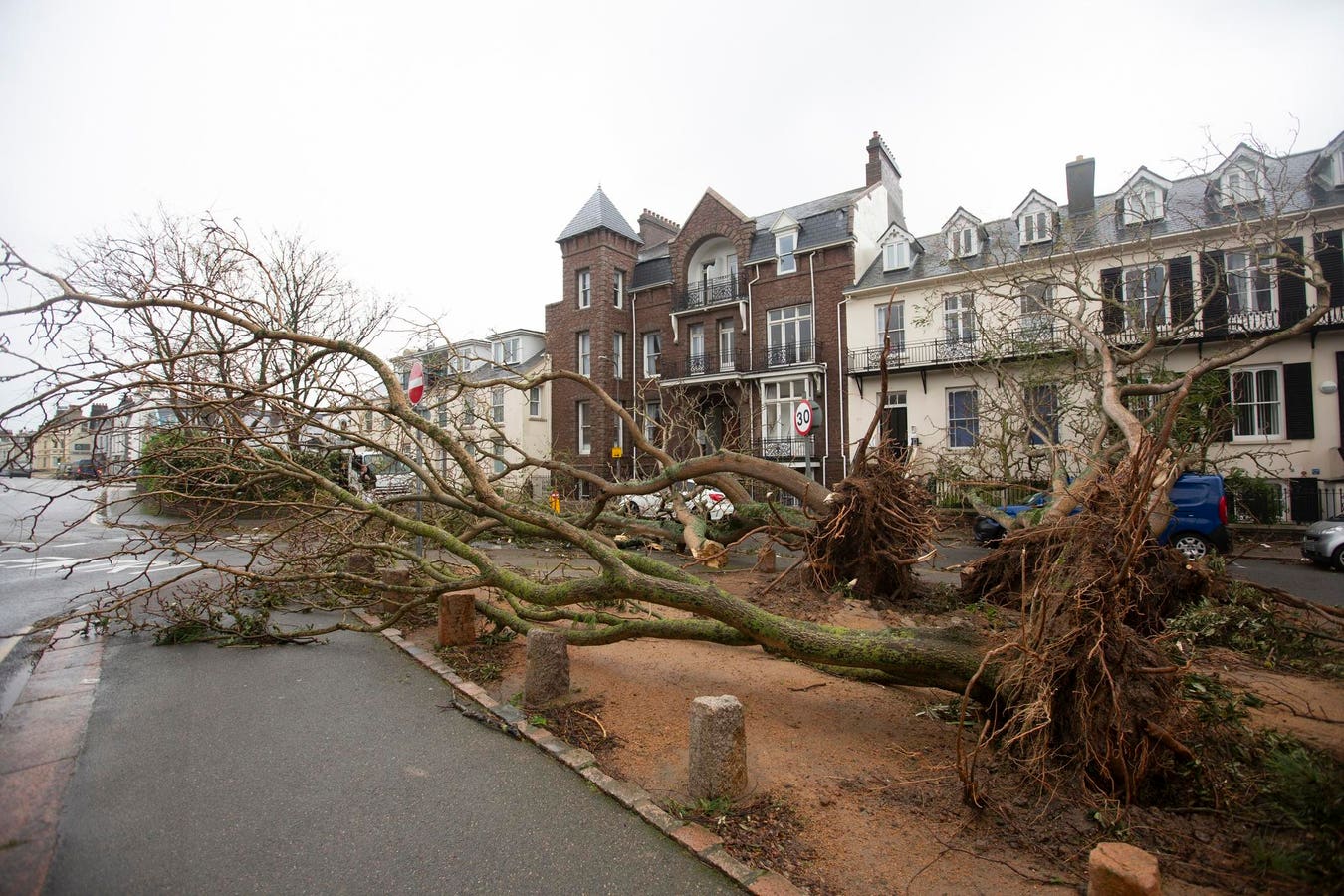
Last night a tornado ripped across Jersey, the Channel Isle better known as a tax haven and location for the detective series Bergerac.
Video footage from MeteoAtlas showed considerable damage, with roofs torn off buildings, brick walls eviscerated, and cars flung meters into the air. Three people were taken to hospital while over 60 others were evacuated from their homes as winds above 100mph and large hailstones battered the island overnight. The home page of Visit Jersey – usual slogan Find Your Perfect Island Escape – warns the airport is shut and main harbour closed.
Storm Ciarán, following close on the heels of Storm Babet just two weeks ago, has been driven by a powerful jet stream from the Atlantic, unleashing heavy rain and furious winds that have already caused heavy flooding in Northern Ireland and parts of Britain. Ciarán hit western Europe on Wednesday night and Thursday. Falling trees have killed at least five people.
Tornados happen mostly in North America, although a very small number are reported each year in the U.K. The Met Office has confirmed that a tornado hit Jersey on November 1.
Ciarán has also set a record, delivering the lowest mean sea level pressure recorded in England and Wales in November. A low pressure system has lower pressure at its centre than the areas around it and tends to create unsettled weather with clouds and precipitation.
British weather is internationally known as bad and now it seems it’s going to get worse. The big question is how much this is down to climate change. According to the latest State of the U.K. Climate report, the U.K. has become wetter over the last few decades, although the extent varies from year to year. Overall, the years 2011-2020 were 9% wetter than 1961-1990.
Although rainfall patterns in the U.K. vary, the country is expected to experience wetter winters and drier summers. Summer rain will likely be more intense. For example, rainfall from an event that typically occurs once every two years in summer is expected to increase by around 25%.
The consequences for infrastructure, transport and the wider economy are significant. More frequent and severe surface water flooding is expected, particularly in urban areas. And as global temperatures rise, the number of extreme rainfall days is expected to increase. The link with climate change is becoming increasingly apparent.
Friederike Otto, a climatologist at Imperial College London, said: “There are a lot of lines of evidence showing that autumn and winter storms like this are more damaging because of climate change. That’s because the rainfall associated with these types of storms is more severe due to climate change, and the storm surges are higher and thus more damaging due to the higher sea levels.”
Dr Melissa Lazenby from the University of Sussex warned that Storm Ciarán will not be a one-off. “Our climate projections are showing that we are going to get higher wind speeds associated with storms (and) more rainfall in shorter periods,” she said.
She added urgent action is needed to help prepare for more extreme weather events in future. “I don’t think the U.K. is at the point where it’s ready for all the extreme events we’re already seeing, whether it be heat waves or… winter storms. We need to put in a lot more… flood defences. I don’t think I can emphasise how quickly (these changes) need to happen.”
Read the full article here


